Menü
About us / Ueber uns - Links - Contact us / Kontakt
About us / Ueber uns - Links - Contact us / Kontakt
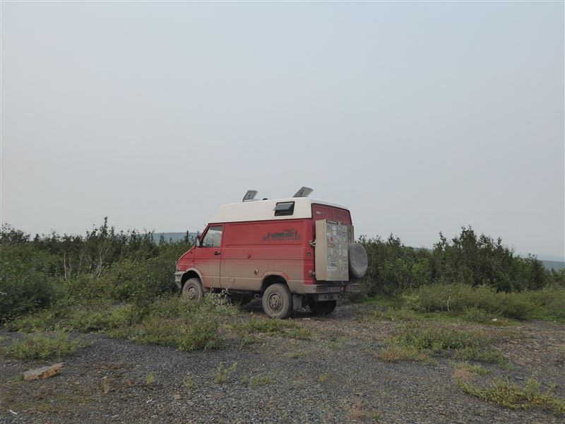
Vehicle / Fahrzeug
Index
Vehicle / Fahrzeug
Vehicle Conversion and first Preparations for the Trip / Fahrzeug-Umbau und erste Reisevorbereitungen
Index
Conversion to a Campervan / Umbau zum Wohnmobil
First Preparations for the Trip / Erste Reisevorbereitungen
Baptism, Party and CD / Taufe, Party und CD
Index
Baptism of Fidibus and Party / Fahrzeugtaufe und Party
Presentation about the "Fidibus-story" / Präsentation der "Fidibus-story"
Baptism of CD "Usse us de Schwiiz" / CD-Taufe: "Usse us de Schwiiz"
Preparations for the Trip / Reisevorbereitungen
Index
Tentative Schedule / Provisorischer Reiseplan
Almost ready to go / Bald bereit für den Start
Reports / Berichte Part 1 (2012 - 2013)
Index
Farewell from Ennetturgi - St. Margrethen via Herisau / Abschied von Ennetturgi nach St. Margrethen via Herisau
St. Margrethen - Krakow via Vienna and Brno / Von St. Margrethen nach Krakau via Wien und Brünn
Krakov - Kiev - Ukrain-Russian Border / Von Krakau nach Kiew an die Ukrainisch-Russische Grenze
Ukrain-Russian Border - Moscow / Von der Ukrainisch-Russischen Grenze nach Moskau
Moscow - Kazan via Golden Ring / Von Moskau nach Kasan via den Goldenen Ring
Kazan - Ekatarinburg via Perm / Von Kazan nach Jekatarinburg via Perm
Ekatarinburg - Irkutsk via Omsk, Novosibirsk and Krasnoyarsk / Von Jekatarinburg nach Irkutsk via Omsk, Novosibirsk und Krasnoyarsk
Irkutsk - Olchon Island - Irkutsk / Von Irkutsk zur Insel Olchon und zurück nach Irkutsk
Irkutsk, Russia - Ulaan Baatar, Mongolia / Von Irkutsk, Russland nach Ulan Bator, Mongolei
Ulaan Baatar - Tsetserleg via Kharkhorin / Von Ulan Bator nach Tsetserleg via Kharkhorin
Tsetserleg - Mongol-Russian Border via Bayan Nuur / Von Tsetserleg an die mongolisch-russische Grenze via den Bayan Nuur See
Mongol-Russian Border - Russian-Khazak Border via Barnaul / Von der mongolisch-russischen Grenze an die russisch-kasachische Grenze via Barnaul
Russian-Khazak Border - Almaty via Rahmanov's Spring / Von der russisch-kazachischen Grenze nach Almaty via Rahmanov's Spring
Almaty - Khazak-Uzbek Border / Von Almaty an die Kasachisch-Usbekische Grenze
Khazak-Uzbek Border - Uzbek-Kyrgys Border via Tashkent, Samarkand and Buchara / Von der Kasachisch-Usbekischen Grenze zur Usbekisch-Kirgisischen Grenze via Tashkent, Samarkand und Buchara
Uzbek-Kyrgyz Border - Karakol via Song-Kol / Von der usbekisch-kirgisischen Grenze nach Karokol via den Song-Köl See
Karakol, Kyrgyzstan - Kashgar, China via Tosorpass / Von Karakol, Kirgisistan nach Kashgar, China über den Tosorpass
Kashgar - Chinese-Mongolian Border, China via the Taklamaklan Desert, Turpan and Urumqi / Von Kashgar an die Chinesisch-Mongolische Grenze, China über die Taklamaklan Wüste, Turpan und Urumqi
Chinese-Mongolian Border - Ulaan Baatar, Mongolia / Von der Chinesisch-mongolischen Grenza nach Ulan Bator, Mongolei
Ulaan Bataar, Mongolia - Beijing, China via Erenhot / Von Ulan Bator, Mongolei nach Peking, China via Erenhot
Beijing - Xining via Xian and Lanzhou / Von Peking nach Xining via Xian und Lanzhou
Xining - Ya'an via Chengdu, China / Von Xining nach Ya'an via Chengdu, China
Ya'an - Chinese-Laotian Border via Shangri-La, China / Von Ya'an zur Chinesisch-Laotischen Grenze via Shangri-La, China
Chinese-Laotian Border - Vientiane, Laos / Von der chinesich-laotischen Grenze nach Vientiane, Laos
Vientiane - Don Khong Island / Von Vientiane zur Insel Don Khong
Don Khong Island - Phnom Penh / Von der Insel Don Khong nach Phnom Penh
Phnom Penh - Seam Reap / Von Phnom Penh nach Seam Reap
Siem Reap, Cambodia - Norththailand - Vientiane, Laos / Von Seam Reap, Kambodscha über Nord-Thailand nach Vientiane, Laos
Reports / Berichte Part 2 (2013 - 2014)
Index
Switzerland - Vientiane, Laos / Von der Schweiz zurück nach Vientiane, Laos
Vientiane, Laos - Jomtien - Bangkok, Thailand / Von Vientiane, Laos via Jomtien nach Bangkok, Thailand
Bangkok - Thai-Malaysian Border / Von Bangkok an die thailändisch-malaysiche Grenze
Thai-Malaysian Border - Kuala Lumpur / Von der thailändisch-malaysischen Grenze nach Kuala Lumpur
Kuala Lumpur - Singapore and Shipping of Fidibus to Brisbane / Von Kuala Lumpur nach Singapur und Verschiffung von Fidibus nach Brisbane
Singapore - Brisbane via Snowy Mountains / Von Singapur nach Brisbane über die Snowy Mountains
Temporary Import of Fidibus to Australia / Temporäre Einfuhr von Fidibus nach Australien
Brisbane - Cairns / Von Brisbane nach Cairns
Cairns - Cape York - Cairns / Von Cairns zum Cape York und zurück nach Cairns
Cairns - Fraser Island - Brisbane / Von Cairns nach Brisbane via Fraser Island
Brisbane - Adelaide via Broken Hill and the Clare and Barossa Valleys / Von Brisbane nach Adelaide via Broken Hill und die Clare- und Barossa-Weingebiete
Adelaide - Bay of Fires - Huonville / Von Adelaide via Bay of Fires nach Huonville
Huonville, Tasmania - Melbourne via Reece Dam / Von Huonville, Tasmanien nach Melbourne via Reece Dam
Melbourne - Sydney via Canberra / Von Melbourne nach Sydney via Canberra
Sydney - Coffs Harbour via Blue Mountains / Von Sydney nach Coffs Harbour via die Blue Mountains
TWO YEARS OF TRAVELLING / ZWEI JAHRE UNTERWEGS
Reports / Berichte Part 3 (2014 - 2015)
Index
Switzerland - Coffs Harbour / Schweiz und zurück nach Coffs Harbour
Coffs Harbour - Mildura / Von Coffs Harbour nach Mildura
Mildura - Birdsville via Old Strzelecki Track / Von Mildura nach Birdsville über den alten Strzelecki Track
Birdsville - Alice Springs via Simpson Desert, Old Ghan Track and Uluru / Von Birdsville nach Alice Springs durch die Simpson Desert, den Old Ghan Track und Uluru
Alice Springs - Kununurra via Tanami Road / Von Alice Springs nach Kununurra über die Tanami Road
Kununurra - Perth via Tableland Track, Gibb River Road and Karijini NP / Von Kununurra nach Perth via den Tableland Track, die Gibb River Road und den Karijini NP
Perth - Kalgoorlie via Wave Rock and Holland Track / Von Perth nach Kalgoorlie über den Wave Rock und Holland Track
Kalgoorlie - Adelaide / Von Kalgoorlie nach Adelaide
Adelaide - Melbourne / Von Adelaide nach Melbourne
Melbourne - Christchurch - Waipara / Von Melbourne nach Christchurch und Waipara
Waipara - Motueka via Slope Point / Von Waipara nach Motueka über den Slope Point
Motueka - Twizel / Von Motueka nach Twizel
Twizel - Picton via Skippers Canyon / Von Twizel nach Picton via den Skippers Canyon
Picton - Waitara via Napier / Von Picton nach Waitara über Napier
Waitara - Auckland via the 90 Mile Beach / Von Waitara nach Auckland via die 90 Mile Beach
THREE YEARS OF TRAVELLING / DREI JAHRE UNTERWEGS
Reports / Berichte Part 4 (2015 - 2016)
Index
Auckland, New Zealand - Thailand - Switzerland - Santiago, Chile / Von Auckland, Neuseeland via Thailand in die Schweiz und weiter nach Santiago, Chile
Santiago - San Antonio - Santiago, Chile / Von Santiago nach San Antonio und zurück nach Santiago, Chile
Santiago and to Santa Cruz, Chile / In und um Santiago und nach Santa Cruz, Chile
Santa Cruz, Chile - San Carlos de Bariloche, Argentina / Von Santa Cruz, Chile nach San Carlos de Bariloche, Argentinien
San Carlos de Bariloche - Peninsula Valdes, Argentina / Von San Carlos de Bariloche zur Halbinsel Valdes, Argentinien
Peninsula Valdes, Argentina - Torres del Paine NP and Puerto Natales, Chile / Von der Halbinsel Valdes, Argentinien zum Torres del Paine NP und Puerto Natales, Chile
Torres del Paine NP/Puerto Natales, Chile - Ushuaia, Argentina via Punta Arenas / Vom Torres del Paine NP/Puerto Natales, Chile nach Ushuaia, Argentinien über Punta Arenas
Antarctica / Antarktik
Ushuaia, Argentina - Chiloé Island, Chile via the Carretera Austral / Von Ushuaia, Argentinien zur Insel Chiloé, Chile über die Carretera Austral
Island Chiloé - Santiago, Chile / Von der Insel Chiloé nach und um Santiago, Chile
Santiago, Chile - Vicuna, Chile via Mendoza, Argentina / Von Santiago nach Vicuna, Chile über Mendoza, Argentinien
FOUR YEARS OF TRAVELLING / VIER JAHRE UNTERWEGS
Vicuna, Chile - Salta, Argentina via Atacama and Paso Jama / Von Vicuna, Chile nach Salta, Argentinienüber die Atacama und den Paso Jama
Salta, Argentina - Colonia del Sacramento, Uruguay and Buenos Aires / Von Salta, Argentinien nach Colonia del Sacramento, Uruguay und dann nach Buenos Aires
Reports / Berichte Part 5 (2016 - 2017)
Index
Buenos Aires - Switzerland - Uruguay / Von Buenos Aires in die Schweiz und zurück nach Uruguay
Colonia del Sacramento, Uruguay - Atlantico, Brazil / Von Colonia del Sacramento, Uruguay nach Atlantico, Brasilien
Atlantico - Curitiba, Brazil / Von Atlantico nach Curitiba, Brasilien
Curitiba - Olimpia via Sao Paulo and Rio de Janeiro, Brazil / Von Curitiba über Sao Paulo und Rio de Janeiro nach Olimpia, Brasilien
Olimpia - Foz do Iguacu via Pantanal, Brazil / Von Olimpia nach Foz do Iguacu über den Pantanal, Brasilien
Foz do Iguacu, Brazil - Altos-Asuncion and the Chaco, Paraguay / Von Foz do Iguacu, Brasilien nach Altos-Asuncion und den Chaco, Paraguay
Altos-Asuncion, Paraguay - La Paz, Bolivia via Potosi and Sucre / Von Altos-Asuncion, Paraguay nach La Paz, Bolivien über Potosi und Sucre
La Paz - Machu Picchu - Amazonas - La Paz / Von La Paz zum Machu Picchu, in den Amazonas und zurück nach La Paz
La Paz, Bolivia - Iquique, Chile via Laguna-Route / Von La Paz, Bolivien nach Iquique, Chile via die Lagunen-Route
FIVE YEARS OF TRAVELLING / FÜNF JAHRE UNTERWEGS
Iquique, Chile - Nazca, Peru via the Andes Mountains / Von Iquique, Chile nach Nazca, Peru durch die Anden
Nazca, Peru - Peruvian-Ecuadorian Border via the Andes and the Amazonas / Von Nazca, Peru zur Peruanisch-Ecuadorianischen Grenze über die Anden und den Amazonas
Peruvian-Ecuadorian Border - Ibarra, Ecuador via Devil's Head / Von der Peruanisch-Ecuadorianischen Grenze nach Ibarra, Ecuador via die Teufelsnase
Reports / Berichte Part 6 (2017 - 2018)
Index
Ibarra - Switzerland - Ibarra / Von Ibarra in die Schweiz und wieder zurück nach Ibarra
Ibarra Southern Colombia - Ibarra / Von Ibarra in's südliche Kolumbien und zurück nach Ibarra
Ibarra - Northern Ecuador - Galapagos - Quito - Ibarra / Von Ibarra nach Nord-Ecuador, Galapagos Inseln, Quito und zurück nach Ibarra
Ibarra, Ecuador - Villa de Leyva, Colombia / Von Ibarra, Ecuador nach Villa de Leyva, Kolumbien
Villa de Leyva, Colombia - Panama / Von Villa de Leyva, Kolumbien nach Panama
Panama - San Jose, Costa Rica / Von Panama nach San Jose, Costa Rica
San Jose, Costa Rica - Switzerland - San Jose / Von San Jose, Costa Rica in die Schweiz und zurück nach San Jose
San Jose, Costa Rica - San Jose / Von San Jose, Costa Rica mit Umwegen zurück nach San Jose
SIX YEARS OF TRAVELLING / SECHS JAHRE UNTERWEGS
San Jose, Costa Rica - Esteli, Nicaragua / Von San Jose, Costa Rica nach Esteli, Nicaragua
Esteli, Nicaragua - Lago de Atitlan, Guatemala via Honduras and El Salvador / Von Esteli, Nicaragua zum Lago de Atitlan, Guatemala über Honduras und El Salvador
Lago de Atitlan, Guatemala - Cancun, Mexico via Belize / Vom Atitlansee in Guatemala nach Cancun, Mexiko via Belize
Cancun - Hierve el Agua, Mexico / Von Cancun nach Hierve el Agua, Mexiko
Hierve el Agua - Mexico City, Mexico / Von Hierve el Agua nach Mexiko Stadt
Reports / Berichte Part 7 (2018 - 2019)
Index
Teotihuacan - Switzerland - Teotihuacan / Von Teotihuacan in die Schweiz und zurück nach Teotihuacan
Teotihuacan - San Miguel de Allende / Von Teotihuacn nach San Miguel de Allende
San Miguel de Allende - La Paz, Baja California via Copper Canyon / Von San Miguel de Allende nach La Paz, Baja California via Kupferschlucht
SEVEN YEARS TRAVELLING / SIEBEN JAHRE UNTERWEGS
La Paz, Baja California, Mexico - San Diego, California, USA / Von La Paz, Baja California, Mexiko nach San Diego, Kalifornien, USA
San Diego - San Francisco via Los Angeles, Joshua Tree NP, Bay of Fires State Park, Las Vegas and DeathValley / Von San Diego nach San Francisco über Los Angeles, den Joshua Tree NP, den Bay of Fires State Park, Las Vegas und das Death Valley
San Francisco, USA - Vancouver Island, Canada / Von San Francisco, USA nach Vancouver Island, Kanada
Vancouver Island, Canada - Tok, Alaska, USA / Von Vancouver Island, Kanada nach Tok, Alaska, USA
Tok, Alaska - Dawson City, Canada via Denali NP / Von Tok, Alaska nach Dawson City, Canada über den Denali NP
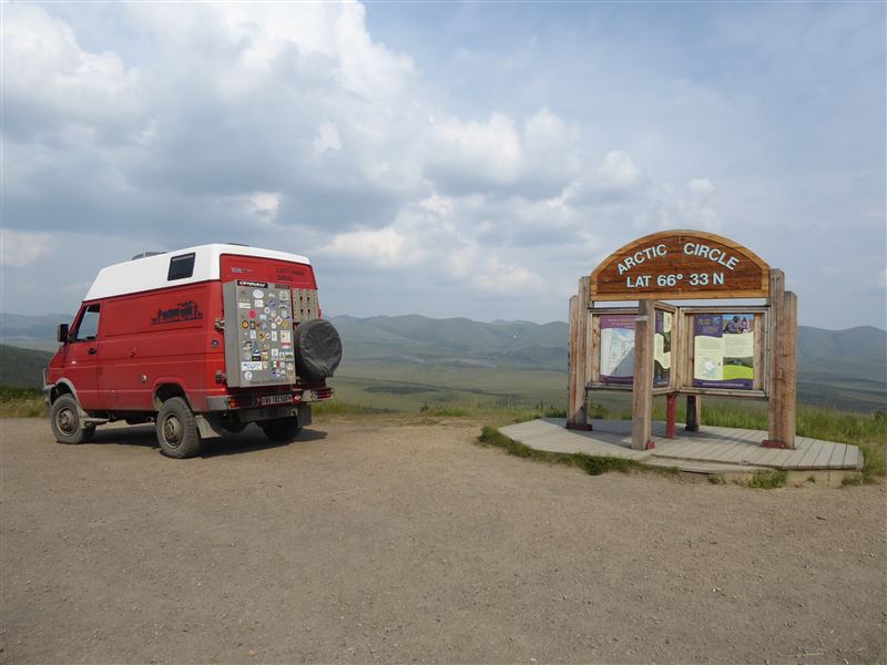
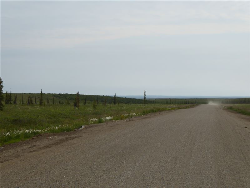
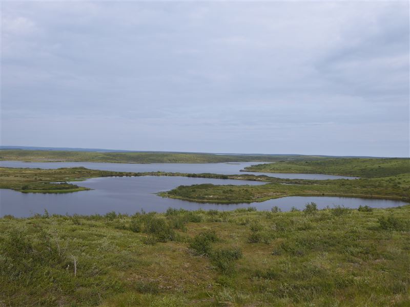
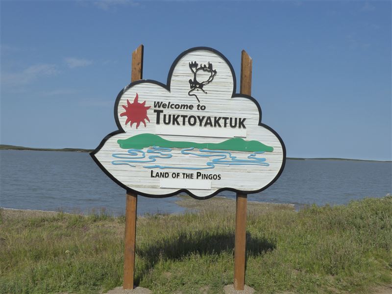
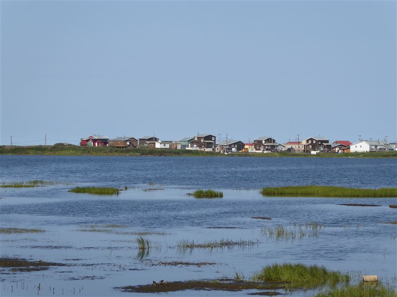
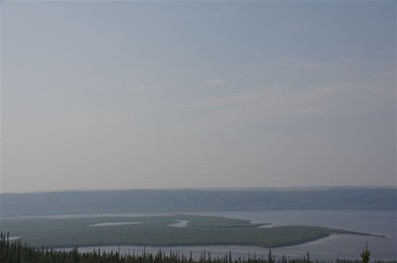
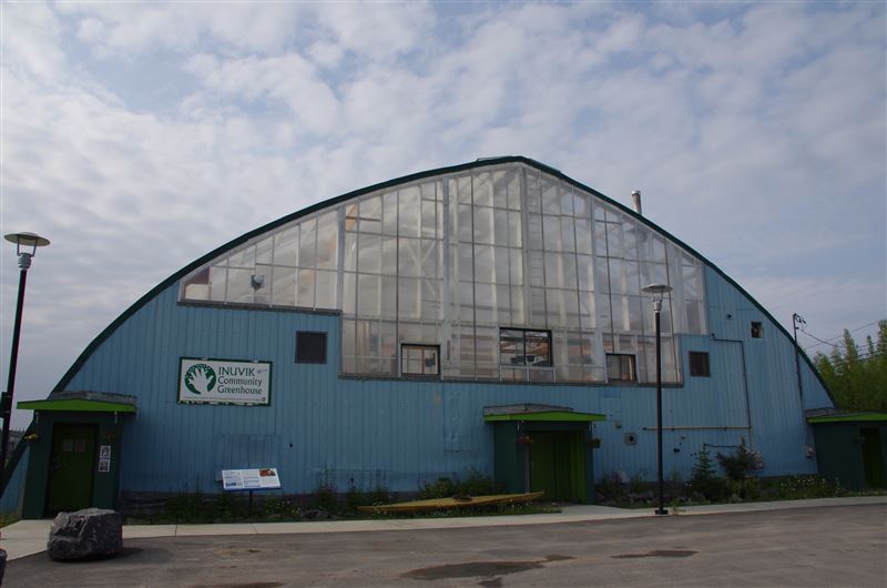
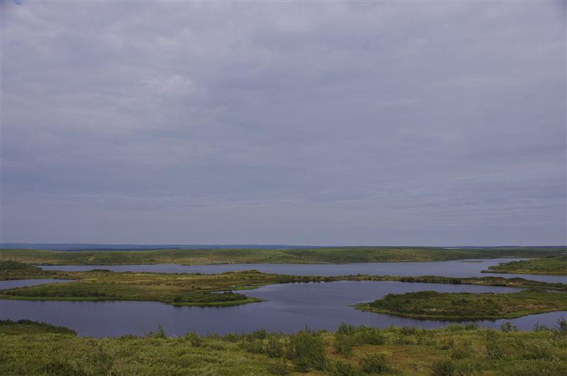
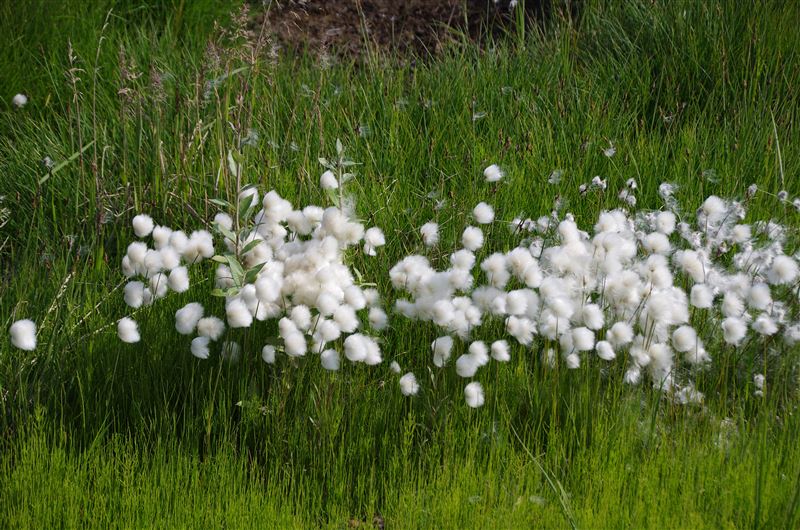
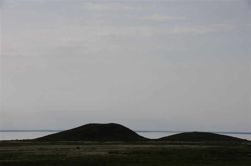
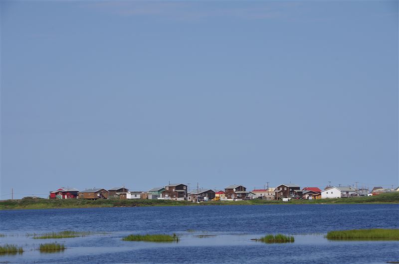
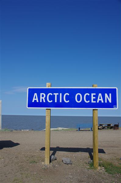
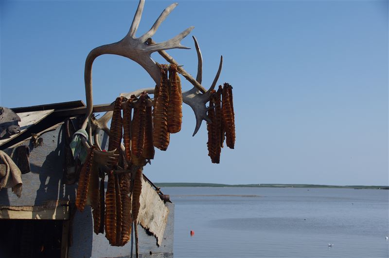
Dawson City - Dempster Hwy - Inuvik - Toktayaktuk / Von Dawson City via Dempster Hwy nach Inuvik und Toktuyaktuk
Dawson City - Calgary via Edmonton and Jasper - Banff NP / Von Dawson City nach Calgary via Edmonton und die Jasper - Banff NP's
Calgary, Canada - Escalante, USA via Glacier, Yellowstone, Grand Teton and Arches NP's / Von Calgary, Canada nach Esclante, USA über die Glacier, Yellowstone, Grand Teton und Arches NP's
Escalante - Las Vegas via Bryce, Zion, Monument Valley, Four Corners and Grand Canyon NP / Von Escalante nach Las Vegas via Bryce, Zion, Monument Valley, Four Corners und den Grand Canyon NP
Reports / Berichte Part 8 (2019 - 2022)
Index
EIGHT YEARS TRAVELLING / ACHT JAHRE UNTERWEGS (2019 - 2020)
Las Vegas – Switzerland – Chile – Switzerland – (COVID) – Las Vegas / Von Las Vegas in die Schweiz, Abstecher nach Chile, danach wieder in die Schweiz (Corona) und zurück nach Las Vegas
Las Vegas, Lake Mead - Death Valley - Las Vegas, Lake Mead / Von Las Vegas, Lake Mead zum Death Valley und zurück nach Las Vegas, Lake Mead
Las Vegas, Lake Mead - Phoenix via Organ Pipe Cactus NP and Tucson / Von Las Vegas, Lake Mead nach Phoenix via den Organ Pipe Cactus NP und Tucson
New foldable Solarcells / Neue faltbare Solarzellen
Phoenix - Houston via White Sands, Big Bend and San Antonio / Von Phoenix nach Houston via White Sands, Big Bend und San Antonio
Houston - Biloxi via New Orleans / Von Houston nach Biloxi via New Orleans
TEN YEARS TRAVELLING / ZEHN JAHRE UNTERWEGS
Biloxi - Savannah via Key West / Von Biloxi nach Savannah via Key West
Savannah - Thedford via Nashville and St. Louis / Von Savannah nach Thedford via Nashville und St. Louis
Thedford - Whalen Island via Craters of the Moon NP and Hell's Canyon / Von Thedfore nach Whalen Island via den Craters of the Moon NP und Hell's Canyon
Whalen Island, Oregon - Icelandic SP, North Dakota via Kelowna, BC / Von Whalen Island, Oregon nach Icelandic SP, North Dakota via Kelowna, BC
Icelandic SP, USA - Prince Edward Island, Canada via Sault Ste. Marie and Ottawa / Vom Icelandic SP nach Prince Edward Island via Sault Ste. Marie und Ottawa
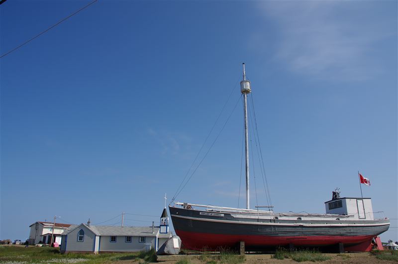
Prince Edward Island - Truro, Nova Scotia via Newfoundland and Hurricane Fiona / Von der Prince Edward Insel nach Truro, Nova Scotia via Neufundland und den Wirbelsturm Fiona
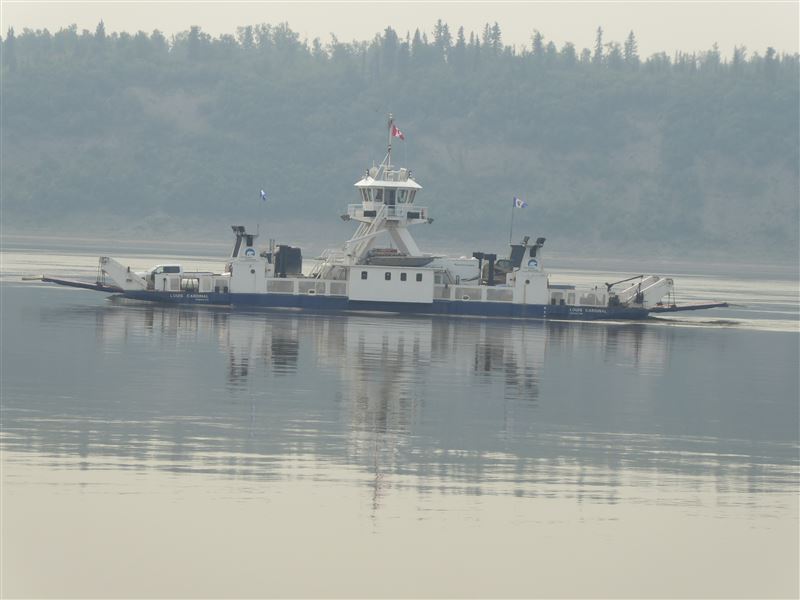
Truro, Canada - Ennetturgi, Switzerland via Halifax, Montreal and Hamburg, Germany / Von Truro, Canada nach Ennetturgi, Schweiz via Halifax, Montreal und Hamburg, Deutschland
Maps / Landkarten